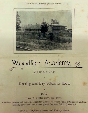


Left: A 1908 view of the Woodford Academy as seen from across the dusty main road. At this time, the railway still provided the main access across the mountains and traffic along the roadway would have been sparse.
Walking up to the main building from here gives you the chance to follow in the footsteps of the dusty students returning to quarters after a rugby or cricket match here on the open playing fields.
Alternatively one could imagine strolling alongside a party of guests returning back to their accommodation through the orchard after wandering around the spacious grounds of Woodford House.
While the highway entry showed off the stature of the Blue Mountains’ oldest building, it was the land out the back where most of the stories unfolded. Today this heritage can be explored by following the ‘Layers in Time Walk’ around the former grounds of the Woodford estate.
The Woodford Academy, a National Trust property and the Blue Mountains oldest building is open to the public on the 3rd Saturday of each month www.nationaltrust.org.au/places/
woodford-academy

This view up to Woodford Academy was taken around the time of the First World War from Woodford Avenue. The avenue was then a fairly new creation that had resulted from the breakup of Alfred Fairfax’s major Woodford estate and the need to build an access road into the Weroona House property constructed c. 1908.

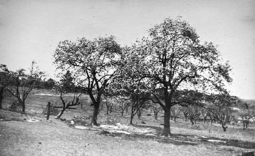
A feature of the photos we have of the Woodford Academy grounds from around the time of the First World War is the way they show the remnant orchard trees still on location and providing a dominant landscape feature.

the distant past
Learning to care for Country was an integral part of the process of growing up for Aboriginal children. Some locations in the landscape were especially important as places of learning for either men’s or women’s lore or as ceremonial or birthing places.

bush corridor wayside
The first schooling to be undertaken in the roadside inn at 20 Mile Hollow would have been done during the time that Captain Bull and his young family occupied a room there in 1842-44.
Once Bull had completed the final stage of the local roadwork improvements from Woodford to Linden in 1844, the convict road gang under his command was moved on to their new barracks at Blackheath.

highway centre
This view of the train approaching Buss’ Platform (soon to be called Woodford) in 1869 shows the major extensions to the inn at 20 Mile Hollow that had occurred over the gold rush era.
From this point onwards the traffic along the road outside the building dropped off dramatically as the new railway took over the transport of both goods and people across the mountains. No longer required for travellers, Buss’ Inn was converted into the country retreat of Sydney businessman Alfred Fairfax.

railway bypass
Following major additions being made, Woodford House was re-opened as a guesthouse in 1885. Advertising branded it as the ‘sanatorium of the Blue Mountains’.
The inn at 20 Mile Hollow’s career as a guesthouse finally came to an end in 1907 when it was adapted for use as a schoolhouse by John McManamey and renamed Woodford Academy.
It operated as a boarding school for boys through until 1925 and thereafter as a co-ed dayschool from 1930-36.

highway centred again
In 1979, the daughter of the Woodford Academy principal – John McManamey – bequeathed the remaining vestige of the property to the National Trust of Australia. Gertrude continued to live at the Academy until two years prior to her death in 1988.


For Darug and Gundungurra Traditional Owners, Ngurra (pronounced Ngoo-rrah) is the term for Country taking in everything within the physical, cultural and spiritual landscape - landforms, waters, air, trees, rocks, plants, animals, foods, medicines, minerals, stories and special places.
It includes cultural practice, kinship, knowledge, songs, stories and art, as well as spiritual beings, and people: past, present and future.
A natural spring in this area along with the tangible cultural heritage that remains within the grounds and nearby, suggest that for Traditional Owners this part of Ngurra embodied high cultural significance as well as an ideal place to stay when seasonally moving throughout Country.
The construction of the road nearby, then the early colonial claim to this land and subsequent establishment of permanent buildings, brought about the dispossession of the Traditional Owners of this part of Ngurra.
With this, Ngurra here was forever fragmented, being colonised into cultivated orchards and grassland, displacing the natural ecosystem that was cared for by Traditional Owners from time immemorial.


Woodford Reserve is a 4.5 acre (1.8 ha) remnant of the original 50 acre holding taken up here by Thomas Pembroke in the 1830s. This central pillar of land provided the core resource for inn keepers operating here through until the late 1860s.
In the 1870s, the then new owner – Alfred Fairfax – added adjoining allotments to the east and west of this 50 acre block to create an estate covering 100 acres of ground which he called Woodford. Fairfax’s sale of this property in 1897 paved the way for a series of subdivisions to occur leading to the present day town layout.
The land now protected in the reserve formed a central part of the Woodford Academy grounds as purchased by the Academy principal – John McManamey – in 1914. Following his death in 1946, the estate passed to his daughter Gertrude. In 1976 she sold this four acre allotment to Blue Mountains Council for the purpose of establishing a public reserve.
Over the next 40 years the grounds were cared for by volunteers who keep the grass in order and planted many of the trees we see on site today. In 2018 the dedicated Woodford Reserve carers were able to finally down mowers when Council commenced maintenance of the Woodford Reserve.
the distant past
For countless generations of Aboriginal people, the location Europeans called 20 Mile Hollow would have been a crossroads in their travels on Country. The water and food resources of this upland swamp, positioned it as a pivotal location in the cultural life of the Darug and Gundungurra peoples.

bush corridor wayside
The upland oasis that was 20 Mile Hollow was contested ground in the early 1830s. Alongside William James’ sly grog shop on the Mountains Road, Thomas Pembroke set up his licensed premises on a 2 acre land grant. Pembroke’s additional 48 acre grant followed in 1835 around the same time as James closed up shop.

This enlarged holding embraced the ground of Woodford Reserve in the heart of 20 Mile Hollow. It allowed Pembroke to establish some gardens and pastures to better serve the needs of the travelling public.

highway centre
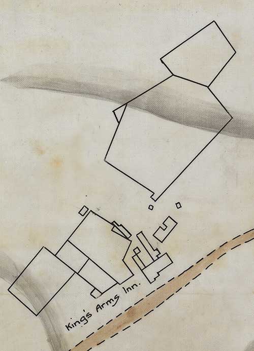
The 1850s goldrush and the surge in traffic along the Mountains Road, led to an upgrade of the facilities provided at 20 Mile Hollow. The railway survey maps of this area from the early 1860s show the building configurations and yards in place at that time.
In addition to the fenced paddocks close by the main inn, the ground down in the swampy areas of the hollow was also enclosed.
Overall the grounds boasted stabling for forty horses and a garden / orchard of about one acre in extent. Six acres of ground were also cultivated for stock feed.

railway bypass
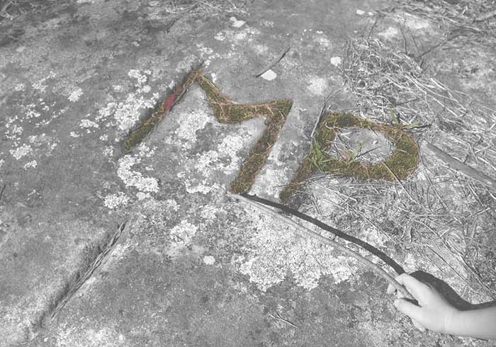
The grounds now enclosed in the Woodford Reserve comprised part of the Woodford Academy’s playing fields from 1907-25 and again in 1930-36. Some of the boys carved their initials into the exposed rock faces across the reserve. Traces of these can be seen in places today.

highway centred again
In 1976, Gertrude McManamey sold Blue Mountains Council 4 acres of land here in order to establish a public recreation reserve. For the next 40 years Woodford Reserve was managed by local volunteers who planted many of the trees we see on site today and kept the grounds in order. In 2018 the volunteers turned their attention to other matters after downing mowers and handing the reserve maintenance over to the Council.


Even as late as 1872 when this atlas map was made, 20 Mile Hollow was recognised as one of the pivotal Blue Mountains’ landmarks.
Its name was a literal recognition of the existence of a roadside hollow offering precious permanent water 20 miles on from the Nepean River.
The enormous value of this resource to travellers was featured in one account of a mountains crossing published in 1827 ...

The changes which have unfolded here at 20 Mile Hollow over the course of the past 200 years can be traced out today by reimagining the bird’s eye views of this landscape.
From its origins as a humble roadside stopover in the 1830s and through to the drama of the gold rush years, the hollow served the needs of travellers using the Mountains Road.
Together with the coming of the railway from 1867 onwards , the name of the hollow was changed to Woodford.
Its focus shifted more from catering for overnight stopover travellers to providing extended stays for people seeking respite from the city.
As the early 1900s ushered in the closer urban development we see around us today, the hollow faded from view in the popular narrative of Woodford. Today its pivotal place in the history of this iconic mountains town is being reassessed and reappreciated from both its Aboriginal and Eurpoean heritage standpoints.

the distant past
This artwork by Chris Tobin was created for display here at 20 Mile Hollow. The circles and the lines linking them portray the connections between the six Aboriginal language groups that care for Country across the Greater Blue Mountains World Heritage Area. The white lines represent springs on Country. They remind us how we all drink from the one water and of our responsibility to care for it.
highway centre
20 Mile Hollow got its name in part by being located 20 miles up the Mountains Road from its start at the Nepean River ford. The term ‘hollow’ reflects the location of the swamp at the head of the valley immediately alongside the roadway.
Powered by a reliable mountain spring, this location was an oasis along the dry mountain ridgetop. The Buss family who ran the inn here from 1856-68 took advantage of this precious water resource. As well as managing a cultivated garden, they nurtured a one acre orchard in the hollow.

The Buss family who ran the inn here from 1856-68 took advantage of this precious water resource. As well as managing a cultivated garden, they nurtured a one acre orchard in the hollow.
railway bypass
Original land grants here in the 1830s saw the upper end of 20 Mile Hollow included in a major 50 acre holding extending northwards from the inn beside the Mountains Road.
After 1870, Alfred Fairfax expanded his land holding here to include the eastern section of the hollow. He also changed the name of the locality to Woodford. It was only after he sold these properties in 1897 that the land was freed up for subdivision by the new owners. This allowed closer settlement around the hollow including the establishment of the Woodford town centre.


